The post-quake concern from friends and family has almost become routine since the tsunami and the Mumbai floods. (In those two cases, though, I could make bad jokes about the "outpouring" of concern and "flood" of emails). Everyone can relax, there has been no significant earthquake in Nepal since 1934. However, supposedly there is one every 75 years here. I guess we have a few more years to go. We are nowhere near Kashmir, unless you are in Ohio, then Nepal and Kashmir are practically roomies, maybe even sharing a bunk bed. Nepal is sandwiched between China and India, but south of Kashmir. My friend in Dharamsala, North India actually felt the quake, and the papers said it registered somewhat here, but I didn't feel a thing except a twinge of jealousy that I didn't get to write a blog full of anecdotes about feeling the earth move.
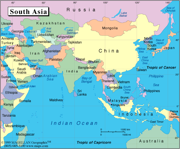
Let me get a map so the gentle readers can brush up on their geography.
Indian Kashmir and Pakistani-controlled Kashmir are up in the "topknot" of the Indian territory. Nepal is southeast of that distinct part of the map. I think somewhere in there is Chinese-disputed-sometimes-Chinese-asserted-and-controlled-on-alternate-phases-of-the-moon Kashmir.
http://www.pbs.org/wgbh/nova/everest/resources/indiamap.html
http://www.askasia.org/image/maps/asias1.htm
But who am I to preach to anyone? - I didn't even know where our neighbor Bhutan really was. Nepal is flooded with Bhutanese refugees, and all this time I had thought Bhutan was somewhere to the West. Bhutan, for those not up on trends in South Asia, is still the mythical, sheltered kingdom that Nepal and Tibet used to be. At least that's what the Bhutanese travel agents say. However, Bhutan is a Buddhist kingdom rather than Hindu like Nepal, so their government offices are probably only closed 145 days of the year for religious festivals. I hear the king outlawed television in an attempt to keep their culture pure. No wonder all the Bhutanese monks come here - they're probably just looking for a place to see Baywatch.
Evidently the subcontinental landmass, which broke away from Africa some bejillion years ago, just keeps ramming into Asia like a persistent mountain goat at the Himalayan fault line, at the rate of 5-6 millimeters per year. This pressure accrues till every so often all Hell breaks loose. In Tibetan Buddhism there are at least 18 different hells, so when the big one finally hits around here, it should be a doozy. (However, a large part of Vajrayana Buddhism involves identifying all these hells in excruciating detail, so the Buddhists will be well prepared. "Oh look, now we're in the one where you see your friends at the top of a beautiful hillside. You wave to them, so glad to see them, and begin running up the hill. Just then each blade of grass beneath your feet turns into a shard of glass, shredding your body to ribbons." I am not making this up-- it's in the Tibetan Buddhists' Comprehensive Field Guide to Hell, ed. by Robert Thurman, foward by HH the Dalai Lama. Okay, that last part I made up.)
Every map of this region has a standard disclaimer saying something like "these national boundaries are not officially confirmed and are subject to dispute," because there are ongoing border disputes between India and Pakistan, India and China, China and Pakistan, and so on. I suppose if a map were published without this tiny statement in the small-print margins, China might get all in a huff and sue the publisher for geographic libel, causing an international incident. It's kind of like, if the Hatfields and the McCoys had a love-hate triangle, with nuclear weaponry instead of muskets and moonshine. Maybe they should just play a giant cricket match
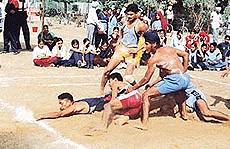 and get it over with; of course, I would think that, because then India would win hands down. Or maybe they can take turns trying to whip one another at each other's national sport - for China it's ping-pong - oh, pardon me, "table tennis"; for India, something called "kabbadi" (everyone knows the national sport is cricket, but no one can admit having a game of British origin as the "official" one) and for Pakistan, honour killings and beheading journalists.
 What used to be Tibet is now euphemistically called "the Tibetan Autonomous Region of China." Nepal catches some criticism for not harbouring enough Tibetan refugees, or for giving those already here a hard time, but I think they are kowtowing to China not out of hatred of Tibetans. Rather, it's just to prevent waking up one day to find themselves newly dubbed the Nepalese Autonomous Region of China. That may be the first and last time I use the word "kowtow" in its original context.
That's all the kowtow from this cowtown for now.
------------------------------------------------------------
Indian plate has become seismically active
Indian Express, October 11:
‘Close monitoring’ of faults neighbouring the one that ruptured under the Himalayas in the 7.6 magnitude earthquake is required as the Indian plate boundary has become seismically ‘very active’.
http://www.expressindia.com/fullstory.php?newsid=56374


No comments:
Post a Comment